Bedford Magazine Explosion


Bedford_Magazine_Explosion,_Nova_Scotia,_Canada,_July_18,_1945

Halifax, having been previously devastated by the Halifax Explosion, had emergency plans in place for such an incident, leading to an orderly and widespread evacuation of Halifax’s northern half. The damage resulting from this incident was far less than that of the Halifax Explosion, however the blasts shattered windows, crumpled roofs, and cracked structures. Very few injuries were reported, with none severe. Patrolman Henry Raymond Craig, a naval seaman on watch that night, was the lone casualty, having rushed to the pier upon noticing a fire, just prior to the initial barge explosion.

The community was still resentful towards the navy for the VE-Day Riots, however the efforts of voluntary firefighting by naval personnel at the ammunition depot helped to alleviate these lingering feelings.

The barge responsible for starting the explosion presently lies on the seabed near the eastern shoreline adjacent to the CFAD Bedford magazine dock.

Ring-necked Pheasant


pheasant004

The ring-necked pheasant found in North America has been described as a mongrel strain, molded by the harsh but efficient process of natural selection. This bird is a curious mixture of Chinese, Korean and Manchurian ring-necks, with a touch of Japanese green and the Caucasian blackneck. They are predominantly Chinese but their cosmopolitan blood lines have resulted in birds which have adapted well to the rigors of life in agricultural areas of this continent.

The original North American introduction took place around 1733 when several dozen blacknecks were introduced to Governor’s Island in New York harbour. this and several later attempts along the East coast were unsuccessful. but in 1881 a release of 21 Chinese ring-necked pheasants in the Williamette Valley of Oregon took hold. A host of introductions of several varieties followed throughout the United States and Canada wherever there was a ghost of a chance of their survival. By the early 1900s pheasants were well established throughout many of the mid-western and northeastern states as well as in the southern part of Canada’s prairie region.

In Nova Scotia the first attempt to introduce pheasants was made around 1856. A number of attempts followed but it was not until 1935 that ring-necks became established. During that year the Kings County Fish and Game Association obtained about 1,000 eggs. They sought the help of local farmers, who placed them under domestic setting hens. The Association obtained only 85 birds from the eggs, but there were liberated. From this and subsequent releases the population became established.

Numbers increased slowly, and in 1943 the first pheasant hunting season was established in Kings County. It was from October 25-31 with a bag limit of three cocks. A series of closures and openings followed. By 1948 a season was in place for Annapolis, Kings, Digby, Hants and Queens counties, and an open season has been in place in all subsequent years.

The population was centered in the Annapolis Valley, and the peak occurred from 1950 to 1955, when hunter harvest ranged between 3,000 and 4,500 cocks. typically, this high population was followed by a dramatic decline.

In an effort to reverse the decline, the government undertook intensive stocking of game farm bird. During 1959 and 1960 over 10,000 birds were stocked throughout the province, with over 5,500 liberated in the Valley alone. In other years lower numbers were released, but the stocking effort failed and the population continued to decline. The small game biologist of the day concluded that these large numbers of game farm birds may have displaced wild birds and thus actually reduced overall production. His studies suggested that the stocked birds contributed little to breeding success.

In the early 60s stocking was virtually discontinued. Pheasants reached a low in 1964, when the Valley harvest was only 649 birds. Despite the lack of stocking (or perhaps because of it) the population began to recover, reaching a high level in the mid-1970s. Although considerable annual variation exists, this healthy population remains relatively high to the present day. Individuals and groups still undertake stocking, but these efforts are unlikely to contribute significantly to our established wild base.

The present wild population is centered in the eastern Annapolis valley, but reasonable numbers exist throughout the rest of the valley as well as along the coastal areas of Digby, Yarmouth and Lunenburg counties. Smaller numbers exist in the agricultural areas of Hants, Halifax, Colchester, Cumberland and Pictou counties. Isolated pockets of pheasants in other areas of the province are usually a product of continual releases of small numbers of birds by local clubs or individuals.

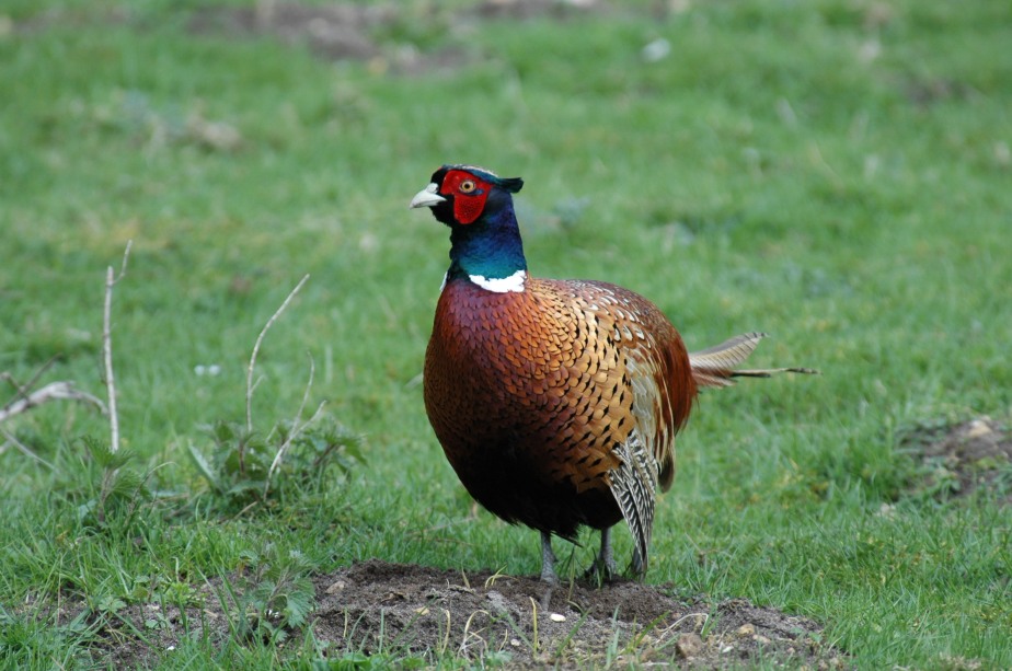
Male pheasants are one of th most conspicuous members of Nova Scotia’s bird community. Weighing about three pounds (1.3 kg) and sporting a tail which may be over 18 inches (45 cm) long, the cock ring-neck can only be described as gaudy. The head and upper neck are covered largely in feathers shot through with iridescent blues, blacks and greens, while the crown is metallic green with short black ear tufts. The bare face patches or wattles are a vivid crimson. below its white neck ring are copper breast feathers with violet iridescence and black tips. The back is marked in a beautiful and complex pattern of rusts, blacks and creams merging into a saddle with delicate hues of bluish-green. A truly colorful bird!

The female by contrast is smaller, with a shorter tail and a drab mixture of browns and greys with buffy underparts. She is well camouflaged and superbly adapted to the task of being inconspicuous while incubating eggs.

Breeding activity begins in April, with cocks setting up territories which they loudly proclaim. Standing erect, they crow lustily while rapidly beating their wings to produce a fluttering, booming sound. The crowing is a strident “cuh-aw-w-w-cawk” that sounds like a rusty gate hinge and can be heard for a mile (1.6 km) on a still morning. Beginning at daybreak each cock announces his territory. During the peak of the breeding season they crow every two minutes, with the frequency dropping off as the sun rises.

Territories are vigorously defended and fighting is frequent and often prolonged. Battling cocks are often so intent on their task that they can be closely approached; fights on the road may hold up traffic until the outcome is decided.

Each cock attempts to attract as many females to his harem as he can, and it isn’t unusual for a wild cock to have six or eight mates. In the courtship ritual the male’s colorful plumage is fully utilized. Approaching a hen, he spreads and lowers one wing while spreading his tail and fluffing his feathers in her direction. With his ear tufts erect, wattles a brilliant scarlet and head held low, he struts before the hen with an exaggerated bobbing motion. Always careful to keep the hen on the side he is displaying, he attempts to impress her with the size and brilliance of his plumage. Cocks who have lost their tails to accidents are at a severe disadvantage in these displays. In one study, it was observed that over half of the full-tailed cocks had hens with them but only 7% of cocks with no tails had hens.

Hens seek a grassy area in which to construct a simple nest of dry grass. Usual locations include hayfields, apple orchards, marsh edges, roadside ditches or weedy fence rows. They prefer relatively open areas with good ground cover.

In Nova Scotia the average date for nest initiation is May 1 and the average clutch size is 13, with nine to 15 being the most common. One egg per day is laid and once the clutch is complete, incubation begins and lasts for about 23 days. The female has sole responsibility for incubation of eggs and care of chicks.

Relying heavily on their drab plumage to keep them invisible, incubating hens are normally reluctant to leave the nest even if closely approached. It is not unusual for a hen to be killed by a mowing machine as she relies on her camouflage to protect her from this noisy “predator”. Eggs may also be lost to skunks, raccoons, foxes or the weather. Prolonged cold, wet weather may saturate nests to the point where the female cannot provide enough heat and the embryos will die. Females who lose their first clutch during egg laying or incubation will normally make a second attempt. In years with a cold, wet spring it may be these second nests which make up the bulk of production.

Eggs which survive to hatch produce young which are well developed and ready to leave the nest to feed on their own as soon as they are dry. To develop properly the chicks require an abundance of protein-rich insects such as grasshoppers and ants. The hen provides warmth during cold or wet weather and is constantly on the look-out for predators. When threatened the chicks normally “freeze”, while the female uses the old broken-wing ruse to lure enemies away.

Prolonged cold, wet weather can decimate these young birds and in some years may severely reduce production. Predators such as raccoons, foxes and house cats may also take their toll; but if habitat and weather are favorable, predation losses are unlikely to have much impact.

Under good conditions the young strengthen quickly, and by two weeks of age are able to fly fairly well, although they are only a quarter the size of the hen. by three months of age the broods begin to break up and the young have to fend for themselves. Young cocks first start to develop their post-juvenile colored feathers at about two months. by five months their plumage is nearly identical to that of adult birds.

Although adult pheasants rely on seeds as a staple diet, they are also fond of many different types of fruit. In the spring and summer they may be tempted by insects and the succulent green growth of a variety of plants. They seem to be particularly fond of the young spinach in my garden and follow this up by a quick trip to the strawberry patch. Food becomes much scarcer in the winter, and this is when pheasants rely most on seeds, particularly those of grain and weeds. Unlike our native ruffed grouse, pheasants don’t normally eat buds, and are therefore much more susceptible to periods of heavy snow when their food may be covered.

When stressed by lack of food, pheasants readily approach human habitations where they feed on manure piles or seeds placed there by sympathetic people. Feeding pheasants is extremely popular among bird fanciers and those with substantial numbers soon learn that the economic and nutritious alternatives include “chicken scratch” and corn. During periods of deep snow, grit should also be provided in the form of small pebbles or a commercial alternative such as that sold for chickens. Like all birds, pheasants lack teeth and must break up seeds in their muscular gizzard using small stones for grinding.

Roosting cover is another important habitat requirement for pheasants. These birds are not active at night and seek out dense stands of vegetation to provide shelter from the weather and predators. they normally roost on the ground in cattails, high grass or low shrubs and they may also spend the night in trees, particularly when cold and wind are not a problem.

Pheasants are best adapted to agricultural areas, and in North America reach their highest concentrations in the wide-open, grain-growing prairies. In Nova Scotia they are most abundant in the eastern Annapolis Valley where substantial acreage is in grain. But they also do fairly well in areas where agriculture is less intensive. For instance, our western coastal areas, which offer light snow cover, hayfields, small gardens and plenty of fairly open habitat with wild rose and other fruiting and seed-bearing plants, also provide adequate habitat.

Ring-necked pheasants were originally introduced to provide another game bird and they have thrived in this role. The male’s ability to breed with several hens leaves surplus cocks available to hunt, with no danger to the population. The extreme color differences between the sexes makes it relatively easy for hunters to tell them apart and, in most jurisdictions a cock-only harvest is the norm.

In Nova Scotia we keep track of the health of the pheasant populations by using spring cock-crowing counts, winter sex ratios and hunter harvest. If we continue to provide a reasonable amount of good habitat for them, they should remain a valued member of our bird community for all future generations of Nova Scotians.

Arthur Bruce “Art” McDonald


nobel-prize-arthur-mcdonald-physics-kingston-ont-oct-6-2015

Arthur Bruce “Art” McDonald, (born August 29, 1943) is a Canadian astrophysicist and the Director of Sudbury Neutrino Observatory Institute. He also holds Gordon and Patricia Gray Chair in Particle Astrophysics at Queen’s University in Kingston, Ontario. He was jointly awarded the 2015 Nobel Prize in Physics, together with Takaaki Kajita.

Early life

Born in Sydney, Nova Scotia, McDonald graduated with a B.Sc. in Physics in 1964 and M.Sc. in Physics in 1965 from Dalhousie University in Nova Scotia. He completed his Ph.D. in Physics in 1969 from the California Institute of Technology.

Academic career

McDonald worked as a research officer at the Chalk River Nuclear Laboratories northwest of Ottawa from 1970 to 1982. He became professor of physics at Princeton University from 1982 to 1989, leaving Princeton to join Queen’s University. He is currently the University Research Chair at Queen’s University and a board member at Perimeter Institute for Theoretical Physics.
Research

Physicists have been investigating whether or not neutrinos have mass. Since the late 1960s, experiments have hinted that neutrinos may have mass. Theoretical models of the Sun predict that neutrinos should be made in staggering numbers. Neutrino detectors on the Earth have repeatedly seen fewer than the expected number of neutrinos. Because neutrinos come in three varieties (electron, muon, and tau neutrinos), and because solar neutrino detectors have been primarily sensitive only to electron neutrinos, the preferred explanation over the years is that those “missing” neutrinos had changed, or oscillated, into a variety for which the detectors had little or no sensitivity. If a neutrino oscillates, according to the laws of quantum mechanics, then it must have a mass.

In August 2001, a collaboration at the Sudbury Neutrino Observatory (SNO), a detector facility located 6,800 feet (2,100 m) underground in a mine outside Sudbury, Ontario, led by McDonald, checked in with a direct observation suggesting that electron neutrinos from the Sun really were oscillating into muon and tau neutrinos. SNO published its report in the August 13, 2001, issue of Physical Review Letters, and it is widely considered as a very important result. McDonald and Yoji Totsuka were awarded the 2007 Benjamin Franklin Medal in Physics “for discovering that the three known types of elementary particles called neutrinos change into one another when traveling over sufficiently long distances, and that neutrinos have mass”.

Charles de Saint-Étienne de la Tour


Port Royal Nova Scotia

Charles de Saint-Étienne de la Tour, the French King’s appointed Governor of Acadia from 1631–1642 and again from 1653–1657, was born in France in 1593 and died at Cap de Sable (present-day Port La Tour, Nova Scotia) in 1666. The communities of Port La Tour, Nova Scotia and Upper Port La Tour, Nova Scotia are named after Charles La Tour.

Early history

In 1610, at the age of 17, Charles arrived at Port-Royal in Acadia with his father, Claude de Saint-Étienne de la Tour, in an expedition that was led by Jean de Biencourt de Poutrincourt who had been one of the original settlers in 1604 at Saint Croix and 1605 at Port-Royal. The habitation had been previously abandoned in 1607 by Biencourt de Poutrincourt and others due to financial troubles. The 1610 expedition also included Poutrincourt’s 19-year-old son Charles de Biencourt de Saint-Just, and a Catholic priest who set about himself the task of baptizing the local Mi’kmaqs, including their chief Membertou.

Battle of Port Royal (1613)

In 1613, the settlement, or habitation, at Port Royal was attacked by colonists from Virginia led by Captain Samuel Argall. Several settlers were killed, others taken prisoner and the fort and goods were destroyed. Poutrincourt who had wintered in France to gather supplies returned to Port Royal the next spring. He was forced to return to France with the surviving settlers. The young Biencourt and Charles de la Tour remained, living amongst the Mi’kmaq, engaging in the fur industry. At this time, la Tour migrated from Port Royal to establish himself at both Cap de Sable (present-day Port La Tour, Nova Scotia) and Saint John, New Brunswick.

Battle of Castine (1626)

In 1625, Charles married an Abenaki Indian, from one of the local First Nations’ tribes and the family built a trading fort at the mouth of the Penobscot River in present-day Castine, Maine. In 1626, the fort was attacked and destroyed by New England colonists. Charles returned to Port-Royal.

In 1631, Charles had become governor of Acadia and moved to the mouth of the Saint John River in present-day Saint John, New Brunswick where he built a new fort. In 1635, he was formally granted a seignory.

Historian M. A. MacDonald writes about La Tour’s possession at the mouth of this river:

Down this river highway came fleets of canoes, bringing the richest fur harvest in all Acadia to Charles La Tour’s storehouses: three thousand moose skins a year, uncounted beaver and otter. On this tongue of land his habitation stood, yellow-roofed, log-palisaded, its cannon commanding the river and bay. (p. 183)

In 1632, Isaac de Razilly the new Lieutenant-general of all New France and governor of Acadia, arrived in Port-Royal, sent by his cousin Cardinal Richelieu. La Tour and Razilly agreed to divide control of Acadia, the latter controlling the south-western corner of Nova Scotia and the territory along the Saint John River]]. Razilly died in 1636, and his successor, Charles de Menou d’Aulnay, began a series of violent and costly confrontations.

During these confrontations, La Tour was accused of treason and crimes against Acadia.

Acadian Civil War

Battle of Port Royal (1643)

In the Spring of 1643, La Tour led a party of English mercenaries against the Acadian colony at Port Royal. His 270 Puritan and Huguenot troops killed three, burned a mill, slaughtered cattle and seized 18,000 livres of furs.

Battle of St. John (1645)

D’Aulnay was able to retaliate in 1645 by seizing all of La Tour’s possessions and outposts, especially Fort La Tour at Saint John and Cape Sable. In the Battle of St. John (1645), La Tour’s second wife, Marie Jacquelin La Tour, defended the fort for three days. On April 17, despite losing thirty-three men, d’Aulnay took control of the fort. La Tour’s men were sent to the gallows. Madame La Tour was taken prisoner and died three weeks later. Meanwhile, La Tour was in the English port city of Boston, drumming up more support for his cause. Nicolas Denys’ letters and journals give vivid descriptions of the drama.

In 1645, while La Tour was in Boston seeking reinforcements, d’Aulnay attacked Fort La Tour. La Tour sought refuge at the Chateau Saint-Louis in Quebec City. D’Aulnay became governor-general and seigneur of Acadia.

In 1650, d’Aulnay died when his canoe capsized. His widow, Jeanne Motin was heavily in debt. La Tour, hearing of the death of d’Aulnay, returned to France and was rehabilitated, going on to become governor of Acadia once again.

On February 24, 1653, Charles La Tour married a third time, to Jeanne Motin, the widow of his former enemy, d’Aulnay. La Tour died at Cap de Sable (present-day Port La Tour, Nova Scotia) in 1666.

LaHave


11889581_10155914490740641_1980075177007063210_n

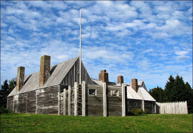
LaHave, once the capital of Acadia/ Nova Scotia, is located across the river from Riverport and approximately 15 kilometres from the town of Bridgewater. It is now a small scenic village located on Highway 331 at the mouth of the 97 km long LaHave River in Lunenburg County, Nova Scotia.

Mi’kmaq Settlement and French colony

La Have was an important centre for the Mi’kmaq people, who traded with Europeans. Messamouet, a well-known sakmow, or Chief, of the Mi’kmaq Nation, is reported to have been from the La Have area.

Samuel de Champlain called there in 1604 on his first trip to Acadia. Henry Hudson made landfall there in 1609 on his voyage on behalf of the Dutch East India company. Despite being shown hospitality by the Mi’kmaq, Hudson’s crew staged an unprovoked assault on the Mi’kmaq settlement. As a result, the Mi’kmaq staged a raid on the next Dutch ship to visit in 1611.

LaHave was the capital of Acadia from 1632, when Isaac de Razilly settled on a point of land at the mouth of the LaHave River, until his sudden death in 1636. Razilly established a colony of 300 and built Fort Ste. Marie de Grace. Razilly reported that the fort was capable of standing against all enemy action, and that he had the military supplies necessary to withstand a six-month siege. There was also a chapel, a store and houses for the workmen in the village. Within twelve months of Razilly’s arrival, La Have was a thriving trading post, the centre for a small farming community in the area, and a major port of call for the large fishing fleet. At one point there were five hundred transient fishermen in the settlement. Upon de Razilly’s death, the new Governor Charles de Menou d’Aulnay moved the Acadians from LaHave to Port Royal, Nova Scotia, which had been given up by the Scottish also in 1632 . His wife Jeanne Motin, “daughter of Louis Motin, Sieur de Courcelles, who in addition to owning shares in the Razilly-Condonnier Company, was the controller of salt stores located at one of France’s colonies, perhaps in the Caribbean”, was of great strategic value in the subsequent struggle with La Tour. Ironically, she became Lady La Tour in 1653 after d’Aulnay’s death and La Tour’s triumphant return with Letters Patent as governor of Acadia. Nicholas Denys and his brother Simon, who had come over with de Razilly, in 1632, set up a “wood working plant” near present day Riverport, Nova Scotia and a fishing station at Port Rossignol (now Liverpool, Nova Scotia). They stayed neutral in the war between d’Aulnay (at Port Royal) and La Tour (at Fort La Tour on the Saint John River).

In 1652, LaHave was still a trading post and was raided by Emmanuel Le Borgne.

During Queen Anne’s War, New Englanders raided the community taking 3 Acadians prisoner (1705).

During King Georges War, two French officers, in a letter from Quebec, reported to the Comté de Maurepas that “the English do not dry any fish on the east coast of Acadia since the war, through fear of being surprised there and killed by the Micmacs.” This fear was well founded as these same officers also advised “… a boat belonging to an English merchantman having landed at La Hève for wood and water, these Indians killed 7 of the crew and brought their scalps to Sieur Marin,…”.

The site of Fort Sainte-Marie de Grace was designated a National Historic Site of Canada in 1924.

Ship building

It was, at one time, the economic centre of fishing, trade and shipbuilding for the surrounding area. The many vessels built in the area include a famous clipper, the barque Stag.

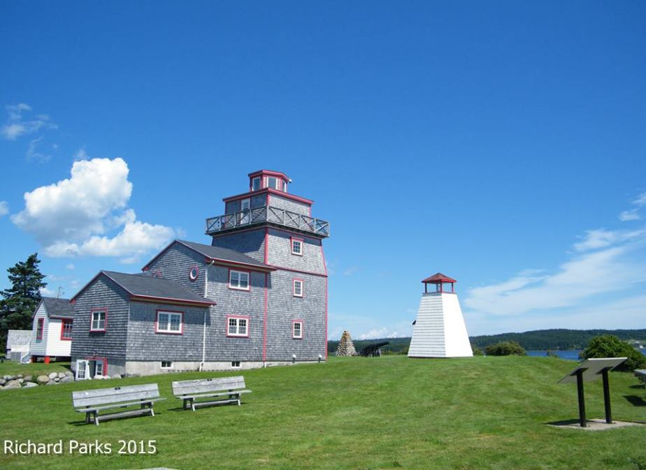
In 1874 LaHave Light Station was built and assisted ships navigating into the LaHave River until the 1950s, when a new lightkeeper’s house was built to replace the aging light station. The light was decommissioned in the 1960s and replaced by a mechanical light on the opposite side of the river. In 1969, the Lunenburg County Historical Society was established to manage this historic site and turned the vacant lightkeeper’s house into a community museum and gift shop. In 2006, the society completed a Renaissance Project, which included the construction and attachment of a new building resembling the original 1874 LaHave Light Station, to the lightkeeper’s house. The new museum is heated and cooled by a geothermal system, one of the first museums in Canada to utilize this technology. The Museum hosts many community events during the year, including the Acadian Mi’kmaq Festival, the LaHave River Folk Festival and a wide range of artistic exhibits.

Lahave River cable ferry

Since the late 19th century, LaHave has been connected to East LaHave, located on the opposite side of the LaHave river, via a cable ferry.

Today LaHave is home to a 14 car cable ferry that crosses the LaHave River from LaHave to East LaHave. The Ferry is Operated by The Province of Nova Scotia and costs $5.50 for a one-way ticket. The trip lasts about five minutes one way.

On Friday, January 3, 2014, the Ferry broke free from its cable and drifted towards the open ocean, running aground at Oxners Beach.

Services

A volunteer LaHave and District Fire Department provides fire and first responder service to LaHave and the surrounding areas. A federal post office, Saint James Anglican Church and LaHave Seafoods are all located in LaHave.

A longstanding turn of the 20th century riverside chandlery landmark, has in recent years become the LaHave Bakery, which operates as a year-round bakery and cafe. The bakery houses a Craft Co-Op during the summer, where local artists sell their crafts. It is also home to a small custom manufacturer, Homegrown Skateboards.

Further down Highway 331, one will find Crescent Beach, a 2 kilometer long beach (only beach in NS that allows you to drive your car on the sand the length of the beach as if it were a road), the LaHave Islands and Risser’s Beach Provincial Park.

The LaHave Islands Marine Museum (c. 1913), located on the LaHave Islands, is on the Canadian Register of Historic Places.

Seal Island Bridge


seal_island

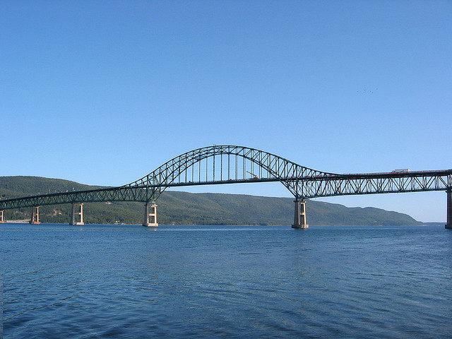
The Seal Island Bridge is a Canadian bridge located in Victoria County, Nova Scotia. It is the third longest bridge span in the province.

It is a through arch design and crosses the Great Bras d’Or channel of Bras d’Or Lake, connecting Boularderie Centre, Boularderie Island on the south side with New Harris, Cape Breton Island on the north side.

Construction

Construction of the Seal Island Bridge began in 1960 as part of the Trans-Canada Highway project. The bridge, officially known as the Great Bras d’Or Crossing, was completed in 1961 at a cost of about $4,652,850. The construction of 23 kilometres (14 mi) of approach roads increased the total cost of the project to about $6-million. The bridge is a crucial link in the Trans Canada Highway between Sydney and Baddeck, carrying more than 7,500 vehicles a day in peak periods. The structure carries 2 traffic lanes of Highway 105 and was originally constructed with a pedestrian sidewalk on each side.

The bridge crosses part of the channel on a causeway connecting the north shore of the channel to Seal Island, a small wooded island. The structure consists of eight steel box truss spans; three simply supported 76.2 m (250 ft) approach spans, two simply-supported 76.2 m (250 ft) splay spans, and a three-span continuous main span that consists of two 106.68 m (350 ft) side spans and a 152.4 m (500 ft) centre arch span. The steel structure is supported on tall reinforced concrete piers, armoured with cut stone at the waterline.

Controversy

The location of the bridge had proven extremely controversial. It replaced two ferry services crossing the Great Bras d’Or; one at the northeastern end between New Campbellton-Big Bras d’Or, and the other at the southwestern end at Big Harbour-Ross Ferry.

For political reasons, it was decided to place the bridge halfway between the two ferry services on account of an outcry by communities fearing the loss of their transportation links. Unfortunately to do this required a massive modification to the Trans-Canada Highway route on the eastern slope of Kelly’s Mountain (240 m (790 ft) high), resulting in a 180° “switchback”.

A safer alternative to continue the highway further east on a gradual descent of Kelly’s Mountain toward New Campbellton, crossing at the northern end of the Great Bras d’Or channel was rejected. Likewise, a route between Beinn Bhreagh and Kempt Head at the extreme southwestern end of the channel (much wider waterway but avoiding Kelly’s Mountain altogether) was never considered. Numerous deaths at the switchback have occurred over the years.

Deck replacement

By 2001 it was found the existing cast-in-place concrete bridge deck was in poor condition. Forty years of wear and tear from traffic, and exposure to wind and salt spray, necessitated a major overhaul of the Seal Island Bridge. The road deck needed complete replacement, and the steel truss work needed reinforcement. Engineers had thoroughly inspected the rest of the bridge structure and found it to be sound and safe. A major deck replacement project was undertaken.

Over the next three years the original cast-in-place concrete bridge deck was removed and replaced using full-depth, precast, prestressed, half-deck width concrete panels. It was necessary to complete one lane at a time, starting with the south lane, leaving the other deck in place so the bridge could continue to be used for vehicular traffic. Construction was completed with minimal traffic disruptions and the bridge remained open to single lane traffic throughout construction, with the exception of three, six-hour overnight closures planned per week. This project added several decades to the useful life of the bridge.

The new high performance precast concrete deck system is much more durable than conventional systems since it is less permeable and crack-free under service load conditions. The deck system adopted is significantly lighter than a conventional cast-in-place concrete deck system. This has resulted in considerable savings in the amount of truss reinforcement required, while providing sufficient mass and stiffness for damping purposes. At the same time the guard rails (traffic barriers) were replaced over the entire length of the bridge, with the new guard rails set inside the main bridge trusses to better protect them from vehicle impact. Unfortunately this made the new bridge deck too narrow to retain the sidewalks so they were not replaced. This modification did result in wider traffic lanes. The overall cost of the bridge deck reconstruction was $15 million. There are now “No pedestrian traffic” signs on each end of the bridge.

Awards

On April 20, 2004 it was announced the Seal Island Bridge Reconstruction Project had won the Lieutenant Governor’s Award for Engineering Excellence. The Department of Transportation and Public Works shared the honours with consultants CBCL Limited of Halifax for the major overhaul of the province’s third largest bridge.

Francis Joseph Fitzgerald


s500.6704

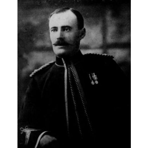
Francis Joseph Fitzgerald was a Nova Scotian who became a celebrated Boer War veteran and the first commander of the Royal Northwest Mounted Police detachment at Herschel Island in the Western Arctic (1903). From December 1910 until February 1911, he led a mail patrol from Fort McPherson southward to Dawson City. When the patrol did not arrive in time, a search party led by Inspector William John Duncan Dempster, was sent from Dawson City and found the bodies of Fitzgerald and the other patrol members. The trip became known as “The Lost Patrol” and as “one of Yukon’s greatest tragedies.”

Early life

Fitzgerald served with the militia in Halifax until the age of 19 and then enlisted as a constable in the North-West Mounted Police on 19 November 1888. He spent the next nine years in the Maple Creek District, Saskatchewan. At age 28, under the command of Inspector John Douglas Moodie, Fitzgerald was the first to chart an overland route from Edmonton to Fort Selkirk, Yukon via northern British Columbia and the Pelly River (1897). The voyage took eleven months, having covered about 1,000 miles (1 600 km). As a result of this achievement, Fitzgerald was promoted corporal in 1899.

Boer War

The following year, under the command of Lawrence Herchmer, Fitzgerald joined the 2nd Canadian Mounted Rifles to fight in the Second Boer War. The mounted rifles participated in a number of major drives that resulted in the destruction of at least twenty percent of the Boer forces in the western Transvaal, most of these being captured. It was not all one-sided, however. On 31 March the unit fought as part of an outnumbered British force at the Battle of Harts River, or Boschbult. When Fitzgerald returned to Halifax after the war, he was given accolades by the local newspapers.

As a result of his service, he came to the attention of Commissioner Aylesworth Bowen Perry in Regina, and he was raised to sergeant after his return to Canada. He went to England in 1902 with the NWMP contingent for the coronation of Edward VII.

Herschel Island

In the summer of 1903 Fitzgerald and a constable were sent to Herschel Island in the western Arctic to establish a police post, where he stayed for six years. His only links with the outside world were the whaling ships that visited occasionally, police whaleboats from Fort McPherson in the Mackenzie delta, and a police patrol by dog sled from that post. Relieved in the summer of 1909, he went to Regina, but in July 1910 he returned to Fort McPherson.

While at Herschel, Fitzgerald had a daughter with an Inuit woman Lena Oonalina (1909). Shortly after, he was promoted to inspector on 1 December 1909. As the first officer posted to Herschel Island, Fitzgerald paved the way for his successors by diminishing the alcohol trade and keeping the peace.

The Lost Patrol

In late 1910 Fitzgerald was selected for the contingent to be sent to George V’s coronation. To get him out of the north in time, it was decided that he would head the annual patrol that winter from Fort McPherson to Dawson, a distance of some 470 miles (750 km). Given the competitive spirit within the police, Fitzgerald undoubtedly saw this trip as an opportunity to break the time record set by an earlier patrol. He therefore decided to lighten the load on his sleds by reducing food and equipment, confident that the quantities normally taken would not be needed.

On 21 Dec. 1910 Fitzgerald left Fort McPherson with three other constables. From the outset, the patrol was slowed by heavy snow and temperatures as low as −62°. They were unable to find the route across the Richardson Mountains. Nine days were wasted searching for it. With supplies dwindling, Fitzgerald reluctantly had to admit defeat and return to Fort McPherson. The patrol now faced a desperate struggle. As food ran out, they began eating their dogs. In the last entry in his diary, on 5 February, Fitzgerald recorded that five were left and the men were so weak they could travel only a short distance. Within a few days all four died, three from starvation and exposure, including Fitzgerald, and one by suicide. Their emaciated bodies were found in March a few miles from the safety of Fort McPherson, where they were buried.

On Fitzgerald’s body was his will, scratched on paper with a piece of charcoal; it read: “All money in dispatch bag and bank, clothes, etc., I leave to my dearly beloved mother, Mrs. John Fitzgerald, Halifax. God bless all.”

Partridge Island


PI_shore

Partridge Island is a significant historical, cultural and geological site located near the mouth of Parrsboro Harbour and the town of Parrsboro on the Minas Basin, in Cumberland County, Nova Scotia. It attracts many visitors including sightseers, swimmers, photographers, hikers and amateur geologists. Partridge Island is actually a peninsula that is connected to the mainland by a sandbar isthmus. According to local legend, the isthmus was created during the Saxby Gale of 1869. The hiking trail to the top of the island affords scenic views of key landforms on the Minas Basin including Cape Blomidon, Cape Split and Cape Sharp. The nearby Ottawa House By-the-Sea Museum contains artifacts and exhibits illustrating the history of the former village at Partridge Island, which dates from the 1770s. Partridge Island is a favourite hunting ground for rockhounds because its ancient sandstone and basalt cliffs are steadily eroded by the fast-moving currents of the world’s highest tides. Rocks and debris worn away from its cliffs are dragged down the beach making it possible to find gemstones, exotic-looking zeolite minerals and fossils. Fossil hunters are warned, however, that although one or two loose specimens may be collected, Nova Scotia law requires that they be sent or taken to a museum for further study, and no fossils may be excavated from bedrock without a permit.

Myth and legend

Partridge Island apparently got its name from a European translation of pulowech, the Mi’kmaq word for partridge. The Confederacy of Mainland Mi’kmaq report that the Mi’kmaq themselves called Partridge Island “Wa’so’q,” which means “Heaven” because the island was a traditional place for gathering the sacred stone amethyst. It was also the mythic home of the grandmother of the legendary Mi’kmaq god-giant Glooscap. According to Mi’kmaq artist and storyteller, Gerald Gloade, the natives also called Partridge Island “Glooscap’s grandmother’s cooking pot” because the waters around the island appear to boil twice a day when air trapped in holes in the basalt is pushed out as the tide rises.

Legend has it that Glooscap lived on Cape Blomidon, across the basin from Partridge Island. His heroic exploits account for key features of the landscape, including perhaps, the dramatic tides of the Minas Basin. When his enemy, Beaver, built a dam across the Minas Channel from Cape Split to the Cumberland side, the waters not only flooded Glooscap’s herbal medicine garden at Advocate Harbour, they inundated the Annapolis Valley. Glooscap arrived on the scene, saw what the Beaver had done, and angrily smashed the dam with his paddle releasing the pent-up waters. According to anthropologist Anne-Christine Hornborg, the daily breaking and re-building of a giant beaver dam serves as a metaphor for the powerful tides of the Minas Basin — not a literal explanation, but a symbolic representation of the natural environment.

Early history

For aboriginal peoples and later European settlers, Partridge Island was an important sea link to other parts of Nova Scotia because of its location at one of the narrowest points on the Minas Basin. The Mi’kmaq name for the settlement at Partridge Island was Awokum, which means crossing-over point or short cut. In the 1730s, two French settlers, John Bourg and Francis Arseneau, operated a ferry service that crossed the basin from Partridge Island.

An interpretive panel at the top of the Partridge Island hiking trail notes that many of Canada’s earliest historical events could have been witnessed from its heights overlooking the Minas Basin. They include the arrival in ancient times of Nova Scotia’s aboriginal peoples; the appearance in 1607 of the French explorer, Samuel de Champlain, who called the Minas Basin, Le Bassin des Mines, as he searched for copper in the red sandstone cliffs; the voyage in 1672 of the first Acadian settlers who sailed by Partridge Island on their way to dyke and farm tidal marshlands across the basin; the arrival in 1755 of the British colonial flotilla that began to forcibly deport the Acadians and in the 1760s, the arrival of New England Planters who settled the vacated Acadian lands.

Military and commercial significance

The village of Partridge Island, established in the 1770s, was the original site of the town that would later become Parrsboro. Its military blockhouse on a high hill overlooking the village was strategically important thanks to a protected, deep-water anchorage and an excellent view of potentially hostile ships plying the Minas Basin. After ferry service was re-established in 1764, Partridge Island continued to be an important link in the sea route to other parts of Nova Scotia, including the capital, Halifax. During the American Revolutionary War, a U.S. privateer captured the Partridge Island ferry cutting communications at a time when American Patriots led by Jonathan Eddy were laying siege to Fort Cumberland, near the present-day Amherst. British forces soon recaptured the ferry and ended Eddy’s siege ensuring Nova Scotia would remain loyal to Britain. The Partridge Island blockhouse was also reinforced with military weaponry, including brass cannons, during the War of 1812. Partridge Island prospered during the latter part of the 18th century. The village boasted an inn and a tavern as well as a store, school and church as it became a flourishing trading centre. Ships from all over the world anchored there delivering goods to the store operated by the family of James Ratchford which, in turn, supplied every town and village on the Minas Basin with manufactured products.

Many factors contributed to the village’s eventual decline, but politics played a significant part. The Ratchfords were staunch Conservatives. After Joseph Howe became the Liberal premier of Nova Scotia, the post office and the customs house moved to Mill Village, site of the present-day Town of Parrsboro, about three kilometres (2 miles) to the northeast. Ratchford’s death in 1836 accelerated the shift to the new settlement, even though Conservative Member of Parliament, Sir Charles Tupper, later tried to reinforce Partridge Island’s status by successfully pushing for the construction of a large ferry wharf, which soon became known as “Tupper’s Snag.” Tupper also purchased the Ratchford home, renaming it Ottawa House, to show his support for Canadian Confederation. Today, there is little left of the Partridge Island settlement, although the historic Ratchford/Tupper home is still there, operating as the Ottawa House By-the-Sea Museum.

Geology and gems

Partridge Island stands at the edge of the ancient rift valley known as the Fundy Basin that was created when the supercontinent Pangaea began to break up about 225 million years ago. As the continental plates moved apart, they ruptured, and blocks subsided along fault lines forming the rift valleys that became sedimentary basins. The Fundy Basin is the largest of these basins in Eastern North America. During the Triassic geological period between 208 and 220 million years ago, rivers swollen by intense rains carried coarse sediments (now sedimentary rocks) from nearby highlands into the Fundy Basin. Other deposits came from wind-blown sand dunes. Later, large lakes formed on the central part of the basin depositing finer sediments up to 1,000 metres thick and, as they dried up periodically, they left behind salt and gypsum deposits.

The red sedimentary sandstone base of Partridge Island dates from the late Triassic period. The covering layer of dark basalt was formed from magma and lava eruptions in the Jurassic period between 175 and 208 million years ago as continental drifting further weakened the earth’s crust. Sandstones and siltstones were deposited on top of the basalt during cycles of drought and rain. Although sandstone is soft and easily eroded, it forms high, steep cliffs where it is covered by basalt. The basalt cliffs of Partridge Island contain small cavities formed when gases escaped as the lava cooled. Water seeping through these cavities or vesicles deposited minerals including gemstones such as amethyst, agate, jasper and calcite. Zeolite minerals such as chabazite and stilbite can also be found at Partridge Island.

Fossils and dinosaurs

Since 1970 when the American paleontologist Paul E. Olsen discovered a neck vetebra of a long-necked dinosaur known as a prosauropod near Parrsboro, the north shore of the Minas Basin has been recognized as an important source of fossils. In 1984, for example, amateur rock specialist Eldon George discovered the world’s smallest dinosaur footprints at Wasson Bluff about 10 kilometres from Partridge Island. Then, in 1986, Olsen and two colleagues announced they had retrieved 100,000 fossilized bones including some belonging to the oldest dinosaurs ever found in Canada.

The cliffs at Partridge Island have not yielded such spectacular fossil finds, but Sarah Fowell, one of Olsen’s students, gathered evidence in rocks at the island concerning a mass extinction of ancient animals about 200 million years ago at the boundary between the Triassic and Jurassic periods. She found what has been described as “a rapid and dramatic changeover” from the wide diversity of Triassic plant life to the much-lower diversity characteristic of the early Jurassic. Olsen said at the time that her findings were consistent with the theory that a giant asteroid collided with the Earth causing the mass extinction which allowed the dinosaurs to flourish unopposed. (Some scientists believe it was also an asteroid collision that wiped out the dinosaurs themselves about 135 million years later.) More recently, however, scientists have theorized that massive volcanic eruptions may have led to the extinctions.

Hiking trail

The three kilometre (1.9 mile) round-trip, hiking trail on Partridge Island climbs quickly to a height of about 61 metres (200 feet) above sea level, but there are four benches to rest on. There is a lookoff at the top of the trail from which a viewing platform offers vistas of more than 60 kilometres (37 miles) of the coastline of the Upper Minas Basin. Prominent features include Cape Blomidon, Cape Split, Cape Sharp, Cape d’Or, and Cobequid Bay. At dusk many lighthouses can be seen on the coasts surrounding Partridge Island. Visitors are advised to stay on the trail and to keep away from the edge of the cliffs, which could give way without warning.

Wildlife

Partridge island has many types of wildlife; both birds and mammals. Mammals that can be viewed include deer, weasels, skunks, porcupines, squirrels, and mice. Many species of birds also inhabit this former island. Owls, blue jays, hawks, eagles and partridges can also be seen at Partridge Island. Various other birds of song also spend time here.

Tidal statistics

An interpretative panel at the lookoff on the Partridge Island hiking trail gives figures on tidal flows through the “Minas Gut”, the section of the basin from Cape Blomidon to Cape Split and across to Partridge Island. “On each run of tide through this channel,” it says, “flows 100 billion tons of water.” The panel adds that more water passes through this channel each day than “the combined discharge of all the world’s fresh water rivers.” Harnessing this tidal energy, it says, could generate enough electricity to equal “250 medium sized nuclear power plants.” During each tide, more than eight cubic kilometres of water are forced through a channel that is barely five kilometres (3.1 miles) wide, raising and lowering the water levels inside the Minas Basin by 12 to 15 metres (39 to 49 feet). Tidal currents in the channel have been calculated to reach speeds of nearly 20 kilometres per hour (12.4 miles per hour).

Bay of Fundy tides are the highest in the world and the highest of all occur in the Minas Basin. Several factors affect the Fundy tides including water depth and the shape of the coastline. Both contribute to a natural Fundy tidal oscillation, or flow of water back and forth, of about half a day, almost matching the half-day tidal cycle of the outside North Atlantic. This matching tidal cycle amplifies Fundy’s tidal range as water flows in and out of the Bay across the threshold of the Gulf of Maine.

Two tales

The narrowness of the Minas Basin in the vicinity of Partridge Island and the Basin’s remarkable tides figure in two tales from the area. The first is a love story from the early 19th century and the second takes place when horsepower supplied the main mode of transportation in the era before automobiles and the internal combustion engine.

Love and Leander

Twenty-five-year-old Ebenezer Bishop from Greenwich in Kings County had fallen madly in love with Anne Lewis who lived with her family on a farm across the Minas Basin in Halfway River about 17 kilometres (10 miles) north of Partridge Island. During the winter of 1809, Ebenezer decided he would ask the 18-year-old Anne to marry him, but the Partridge Island ferry was not running because of thick ice in the Minas Channel. He enlisted the help of his friend, Nathaniel Loomer of Scot’s Bay, who made a notched board or pole for Ebenezer to use as he crossed the ice floes. Ebenezer set out at daybreak during the brief period when the tide was slack, neither moving in nor out, and the ice pack was at rest. He decided to head for Cape Sharp, west of Partridge Island, but halfway across, the ice began to sink under him. He lay flat, and using the board as a bridge, managed to haul himself safely to another floe eventually reaching the cliffs at Cape Sharp. By dusk he had arrived at the farm where Anne was making supper. She readily agreed to marry him. Ebenezer rode back to Greenwich on a horse he borrowed from Anne’s father returning to marry his sweetheart on November 1, 1809. The two sailed across the Basin to their new home where they lived together for many years. Anne and Ebenezer had seven children, naming one son John Leander, after the young man in Greek myth who swam the Hellespont to make love to the priestess, Hero. John Leander Bishop became a doctor and later served as a surgeon during the American Civil War.

The amazing “sea horse”

The second tale, related by the travel writer Will R. Bird, occurs at a time when men from the north shore of the Minas Basin used to cross the water to buy horses from farmers in the Annapolis Valley. During his summer travels in the late 1950s, Bird encountered an oldtimer on a farm near the Parrsboro golf course across the harbour from Partridge Island. “You ever hear of our sea horse?” the oldtimer asked. “There ain’t nothing to match it in Nova Scotia.” The story begins when Tom Smith crosses over to buy a mare from a man in Canning. The mare then had a black foal that “was one of the finest ever seen on this shore.” After about seven years, the farmer from Canning showed up at Smith’s farm and, obviously regretting that he had sold the mare, he offered Smith “more’n twice the going price” for his fast, black horse. “Tom was a man who watched the dollars and he just couldn’t resist,” the oldtimer said. The farmer from Canning took the boat back while Smith drove the horse around the Basin to deliver it. “He was no more’n back home,” the old man said, “when he happened to look toward the pasture and there was the black horse. Tom couldn’t believe his eyes.” When he went down to the beach, he saw hoof marks showing where the animal had come ashore. Apparently, the horse had known to wait for low tide before attempting the crossing, but, it “made a mighty long swim just the same.” The story ends with Smith returning to Canning to give the money back. “He told the man he couldn’t sell a horse that wanted to be with him that much, and the stranger agreed.”

Long Island (Nova Scotia)


digby1

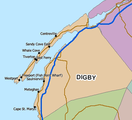
Long Island is a Canadian island in Digby County, Nova Scotia. Situated in the Bay of Fundy immediately southwest of the Digby Neck, Brier Island is located immediately west. Long Island is separated from the Digby Neck by the “Petit Passage” and from Brier Island by the “Grand Passage”. Route 217 runs the length of Long Island from the ferry crossing at Tiverton at the eastern end of the island (connecting to East Ferry on the Digby Neck) to the ferry crossing at Freeport at the western end of the island (connecting to Westport). Long Island is approximately 15 km long and 5 km wide and is primarily basalt rock of the North Mountain ridge. The southern coast (St. Mary’s Bay side) of the island is mostly faced with steep cliffs with the north coast (Bay of Fundy side) featuring smaller cliffs and round-rock beaches. There are several coves along both sides with Bear Cove (in Tiverton), Israel’s Cove (also known as Pirate’s Cove, located in Tiverton), Flour Cove (central on the island), and Beautiful Cove (in Freeport) being the best known and easily accessed coves. There two shallow lakes located together in the centre of the island with a small brook leading in either directions and ending on either end of the island, one in Tiverton and the other in Freeport. There is a tidal bore that occurs on the outgoing (ebb) tide in St. Mary’s Bay just south of Petit Passage that is commonly referred to as The Bull. Long Island was first discovered by the explorer Samuel de Champlain in 1604 but was not settled until the late 18th century when the land was granted to British loyalists who fought for the British against the Americans in the American Revolution. The primary industry is lobster catching with a season running from the last Monday in November until the last day of May. A second, and growing industry, is tourism. The Bay of Fundy is known for whale watching and Long Island offers several tour operator throughout the summer months. Another attraction is Balancing Rock, a large basalt column that appears to be balancing on its end on the southern shore just outside of Tiverton. It also has commonly sited deer, sea birds, and as of 2013 a bear which hasn’t been seen in a century. Sometimes you can see whales from the water’s edge.

Charles Fenerty


220px-Charles_Fenerty_-_c.1870's_(Nova_Scotia,_Canada)

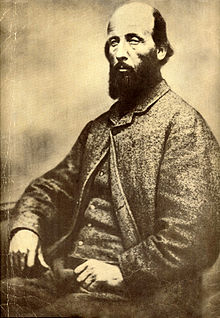
Charles Fenerty (January, 1821 – 10 June 1892), was a Canadian inventor who invented the wood pulp process for papermaking, which was first adapted into the production of newsprint. Fenerty was also a poet (writing over 32 known poems). He also did extensive travelling throughout Australia between the years 1858 to 1865 (living in the heart of the Australian gold rushes).

History of paper (before 1844)

Before wood pulp, paper was made from rags. Paper making began in Egypt  c.3000 B.C. In 105 AD, Cai Lun a Chinese inventor, invented modern paper making using rags, cotton, and other plant fibers by pulping it. Then in the 18th century a French scientist by the name of René Antoine Ferchault de Réaumur suggested that paper could be made from trees. Though he never experimented himself, his theory caught the interest of others, namely Matthias Koops. In 1800 Koops published a book on paper making made from straw. Its outer covers were made from trees. His method wasn’t like Fenerty’s (pulping wood); instead he simply ground the wood and adhered it together. His book does not mention anything to do with wood pulping.

Friedrich Gottlob Keller

Coincidentally, in around 1838 a German weaver by the name of Friedrich Gottlob Keller read Réaumur’s report and got curious. Unaware of Fenerty across the ocean, he experimented for a few years and, in 1845, filed for a patent in Germany for the ground wood pulp process for making modern paper. This was the beginning of a very large industry that exists to this day. In that same year Henry Voelter bought the patent for about five hundred dollars and started making paper. Keller did not have the funds to do it. At one point he did not have sufficient money to renew his patent. Keller died poor, but well remembered in Germany as being the first to discover the process.

Early life

As a youth, Charles worked for his father in the family lumber mills. During the winter months the Fenertys would clear-cut the local forests for lumber (something Charles did not like). It would then be transported from neighbouring lakes to Springfield Lake (where their lumber mill was located). The lumber would then be hauled into the mill and cut up. The Fenertys would ship their lumber to the Halifax dockyards, where it was exported or used for local use (since Halifax was going through a “building boom” at the time). He had two brothers (he was the youngest boy), both of whom helped with the operations. Charles was also a farmer. The Fenertys had around 1,000 acres (4.0 km2) of farm land. They would ship most of their produce to the markets in Halifax. It was in his youth where he was inspired by both nature and poetry. His first (known) poem was titled *The Prince’s Lodge (later retitled as “Passing Away” and published in 1888). He was 17-years-old when he wrote it. It was about the decaying home (overlooking the Bedford Basin near Halifax) that was built decades prior by Prince Edward Augustus, Duke of Kent and Strathearn. The lodge was in poor condition, and was not occupied as Prince Edward return to England in August 1800. He would have had passed this home every time he hauled his lumber and produce to Halifax. But he would pass the local paper mills too.

In those days paper was made from pulped rags. It was a technique used for nearly 2000 years. And suddenly demands reached their peak, while rag supplies reached its all time low. Charles was very curious of how paper was made, and often stopped at these paper mills. There were many similarities between paper mills and lumber mills; something young Fenerty saw and experimented with. Demand for paper was so high that eventually Europe starting cutting down their shipments of cotton to North America. After seeing how paper is made and comparing it to the saw mills, it is not difficult to imagine how Fenerty got the idea (since the process is very much the same: fibres are extracted from the cotton and used to make paper). And Charles knew very well that trees have fibres too (from his relationship with the naturalist Titus Smith. At the age of 17 (in c.1838) he began his experiments of making paper from wood. But 1844 he had perfected the process (including bleaching the pulp to a white colour). In a letter written by a family member circa 1915 it is mentioned that Charles Fenerty had shown a crude sample of his paper to a friend named Charles Hamilton in 1840 (a relative of his future wife).

Fenerty’s invention

Charles Fenerty began experimenting with wood pulp around 1838. And in 1844 he made his discovery. On October 26, 1844 Charles Fenerty took a sample of his paper to Halifax’s top newspaper, the Acadian Recorder, where he had written a letter on his newly invented paper saying:

Messrs. English & Blackadar,

Enclosed is a small piece of PAPER, the result of an experiment I have made, in order to ascertain if that useful article might not be manufactured from WOOD. The result has proved that opinion to be correct, for- by the sample which I have sent you, Gentlemen- you will perceive the feasibility of it. The enclosed, which is as firm in its texture as white, and to all appearance as durable as the common wrapping paper made from hemp, cotton, or the ordinary materials of manufacture is ACTUALLY COMPOSED OF SPRUCE WOOD, reduced to a pulp, and subjected to the same treatment as paper is in course of being made, only with this exception, VIZ: my insufficient means of giving it the required pressure. I entertain an opinion that our common forest trees, either hard or soft wood, but more especially the fir, spruce, or poplar, on account of the fibrous quality of their wood, might easily be reduced by a chafing machine, and manufactured into paper of the finest kind. This opinion, Sirs, I think the experiment will justify, and leaving it to be prosecuted further by the scientific, or the curious.

I remain, Gentlemen, your obdt. servant,

CHARLES FENERTY.

The Acadian Recorder
Halifax, N.S.
Saturday, October 26, 1844

Death and legacy

Little attention was given and even Fenerty himself never pursued the idea and he never took out a patent on his process. But it did mark the beginning to a new industry, although today most people attribute F. G. Keller as the original inventor.

Fenerty travelled to Australia then returned again to Halifax in 1865. He held several positions: Wood Measurer, Census Taker, Health Warden, Tax Collector for his community, and Overseer of the Poor. He was also very involved with the Church. Fenerty died on June 10, 1892 in his home in Upper Sackville, Nova Scotia, from a flu.

Fenerty was also a well-known poet of his time, publishing more than 35 (known) poems. Some popular titles were: “Betula Nigra” (about a Black Birch tree), “Essay on Progress” (published in 1866), and “The Prince’s Lodge” (about Prince Edward Augustus, Duke of Kent and Strathearn, written around 1838 and published in 1888). In October 1854, he won first prize for “Betula Nigra” at the Nova Scotia Industrial Exhibition.

Pulped wood paper slowly began to be adopted by paper mills throughout Canada, the U.S., and Europe. Then to the rest of the world. Charles would live to see the very first wood pulp paper mill erected near his home town (where some claim he worked part-time in his latter years). German newspapers were the first to adopt the process, then other newspaper made the painful switch from rags to wood pulp. By the end of the 19th century almost all newspapers in the western world were using pulp wood newsprint.